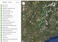
Hiking 700k from Avignon to Mont Blanc May 29th to July 12th 2012
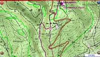
I already had a bookshelf full of French IGN maps covering the areas at a scale of 1:100,000, and Ian downloaded hundreds of IGN maps at a scale of 1:25,000. Having them on a computer saves 2kg in weight with all the maps we'd need, but the Samsung 7.5inch notepad only weighs 300g. These maps coupled with a GPS app we would find out on the track, worked like magic with the GPS overlaying the IGN maps and pinpointing our position exactly, even giving a compass reading North.
After 2 months of planning, our 7 week itinerary became:
- Paris - French Open - May 29 to June 2
- Roussillon to Sisteron - GR6 - June 2 to June 6
- Sisteron to Bayons GR6 - June 6 to June
- Bayons to Briancon - Poncon, GR6531D - June 11 to June 15
- Briancon to Modane - GR55 - June 15 to June 23
- Modane to Mont Blanc - Gr5 - June 23 to June 30
- Tour de Mont Blanc circuit - GR TMB - June 30 to July 10
- Culoz and Paris - Tour de France - JUly 10 to July 12
- Home
The total distance done in three stages (Avignon to Sisteron, Sisteron to Les Contamines, Tour de Mont Blanc circuit) was around 650km over 34 walking days was about 20k - some days 12 k others 28k. I already had a bookshelf full of French IGN maps covering the areas at a scale of 1:100,000, and Ian downloaded hundreds of IGN maps at a scale of 1:25,000. Having them on a computer saves 2kg in weight with all the maps we'd need, but the Samsung 7.5inch notepad only weighs 300g. These maps coupled with a GPS app we would find out on the track, worked like magic with the GPS overlaying the IGN maps and pinpointing our position exactly, even giving a compass reading North.
Bookings
Once the route had been settled on, I booked a few hotels/ refuges in strategic locations. The first week in Provence was fairly predictable so places were booked at St Saturnin-Les-Alpes, Chaloux, St Etienne, Sisteron, Authon and Bayons.
The last 2 weeks around Mont Blanc were also predictable so 10 places were booked ahead.
Les Contamines - Hotel Gai Soleil
Les Houches - Hotel Beausite
La Fagiere - Refuge La Flagiere
Forclaz - Hotel de Forclaz
Champex - Refuge du Plein Air
La Fouly - Hotel Edelweiss
Walter Bonnatti - Refuge Walter Bonnatti
Courmayeur - Refuge Maison Veille on Checroit
Les Chapieux - Refuge de la Nova
Les Contamines - Gai Soleil
The 3 weeks in-between were a bit unpredictable, mostly because we were yet to know if some of the Vanoise high mountain passes (Col de Chaviere and Col de la Leisse being close to 3000m), were still covered in snow necessitating a train/bus around and making bookings messy. So I made a detailed list of accommodation options in many places, using a combination of google maps and trip advisor to make sure we knew the places that were out of town. Nothing worse that hiking a 28k day and finding your B and B is 3k down the road - OK if you're in a car or on a bike but not if you're walking.


