DAY 10: Monday June 11th - Fombeton to Seyne:
Walk: 26.5k, 8hrs: blue skies all day: 15°C to 20°C
Accommodation: Hotel La Chaumiere Seyne
The rain has cleared and we have clear blue skies. The walk today is firstly by car from Fombeton to Bayons by car, then a walk to Seyne which became 4k longer as we mostly followed country minor roads to steer around tracks that were very steep. Our only hiccup was crossing a shaley cliff face that we later found was closed because it was so dangerous.
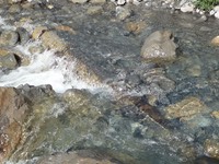
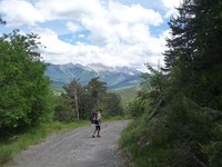
We were up early, finished packing, then down to have a quick cup of tea and rice cake/meusli before Phil and Diane kindly gave us a lift back to Bayons outside the Chambre d'hôte Les 3 Pitchoeuns, where we had finished 2 days before. The rain from the previous day had stopped but the creeks were still swollen with water making the first stream difficult to cross without getting sodden shoes. We follow the Torrent de Sasse up through a gorge on a gravel road - it gets steep. We stop for a cup of coffee before the final ascent up the gorge.
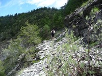
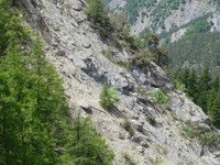
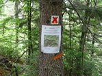
Then the gravel road gives way to a narrow track which gets higher, narrower and very dangerous. We come across a vertical cliff face covered in shale and the track crosses it horizontally for about 1k. We precariously tread across the narrow track with loose shale - it's a damn long way down. When we get to the end of this nightmare section and join another gravel road, there's a sign pinned to a tree "DANGER - GR6 closed" - we hadn't seen any sign at the start. The alternative was to take another goat track around the other side of the mountain that would have taken us an extra 10k to join up. It would have been a toss up had we known before we attempted the crossing - narrow shaley path OR 10k extra.
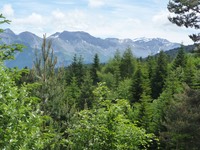
We are glad to have it behind us and when the gravel road reaches the top, we find a sunny spot (it's still 15°C) and sit down for lunch. We are now very close to the Alps - we can see them just across the next valley so we'll be really in amongst the mountains from here on in. We check out the IGN maps to see how far we have been and how far we have to go. Ian has been using a menu function on the GPS tracker that tracks our route precisely, gives the time, average speed, maximum speed and distance travelled - another piece of magic. We had done 14.5k so probably another 10k to go. It's all downhill from here (except for the last 1k into the village of Seyne perched on a hill top) so it should be easier.
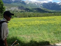
The valley below is dotted with small villages, Selonnet, Surville and in the distance, Seyne. It's all beautiful and green with cows in the pastures. We cross the Durance River, not much more than a trickle as the huge Serre Poncon dam is up ahead blocking its water flow.
We walk down and down into the valley, Selonnet and Seyne, the little villages below seem so close. A few wrong turns put right by the GPS and we are walking along a country lane towards Seyne. We arrive but there's still another 500m to go – and it’s up and up. It's a steep climb up to the village and then we have trouble finding the hotel. 5 mins later - it's the only hotel/restaurant in town (Hotel La Chaumiere) and we're in our room having a hot shower. It had been recently renovated, and the shower cubicle had more knobs and buttons than Inspector Gadget. Once you realised that the red hot button was really the cold and the blue cold button was really the hot, then waited 10 minutes for the water to come through, it was fine. But don't press the flick handle or else you get sprayed with a burst of cold water from above.
We had an early dinner for a change - 7pm. We are the only guests in the hotel so I think he was keen to clean up and move us on. But the dinner was quite nice - shredded carrots and couscous, followed by veal slices and a quiche tart with spinach and cheese. Dessert was tinned fruit.
It was a long day to day, so when we have finished dinner, I type some diary and we are in bed asleep by 8.30pm.
