DAY 12: Wednesday June 13th - Costeplane to Savines Le Lac:
Walk: 26k, 8hrs30mins: Blue Skies,4°C to 18°C
Accommodation: Hotel Les Chaumettes Savings Le Lac
A really hard day. Our GPS worked perfectly but our maps had not been updated by IGN from the FF Randonnee association to show the new Lac de Serre Poncon cycling track which we were following, and the yellow/black signs were few and far between - I'll have a word with IGN about this. So after 3k extra back tracking, then over the Mountains of Morgon, we arrived into Savines le Lac at 6.15pm buggered.
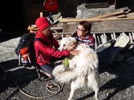
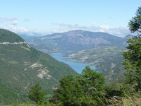
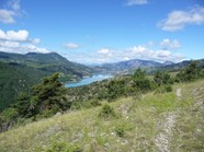
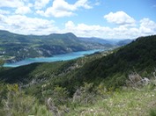
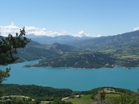
We awoke early to have breakfast with views of Mount Dormilouse on the opposite side of the ravine - capped with powdery snow from two nights before. It’s at 4°C when we pack, say goodbey to Patricia and the sheep dog, and set off along a well marked wide track with spectacular views of the lake.
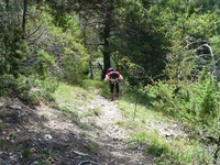
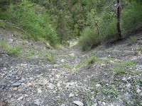
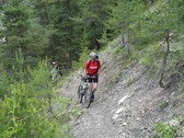
The track widens and we climb a steep gravelly track for about 1k, digging the poles in and pulling up. At last we get to the top and follow a track deep into the forest, but when Ian checks the GPS, we are way off mark! Ian walks around checking the GPS pointer on his Samsung tablet and pinpoints where the track should be - straight down a giant slippery landslide into the valley below- NO WAY are we going down there. We have to back-track down the steep slope we just came up - it was bloody hard coming up but fn hard going back down. My shoes are now coming unglued and the worn soles are like skates. Half way down we see a yellow/black turn marker - and IGN don't know about this detour?? We follow this obscurely marked goat trail and find two cyclists pushing their bikes up towards us and they ask us if the track gets any better where we’ve just been. It makes me feel better knowing we are not alone on these unmarked cycling trails. For the next 10k we are constantly being rerouted off track, by our GPS. At 1.10pm, we think it’s only 1k to the road, but 2hrs later after getting lost and detoured, and climbing hills so slippery with mud we reach the road and sit down exhausted. We are supposed to be finished the whole walk by now and there's still 10k to go - and no gas to have a cup of tea.
We decide to follow a real road down to the valley - at least there won't be any surprises. But 10k down takes us 2hrs 30mins - at least the views of the lake continue to inspire on this picture post card day. We take a small detour to Les Eygoires hoping to buy a cup of tea. But the place is deserted - there's lot's of cabins used for by holiday makers for winter and summer sports, but not now in early June. No cup of tea. We trudge down the road, and with only 3k still to go, come across a roadside snack bar - tea time - and we can see Savines Le Lac in the distance. It's easy to see why they flooded the valley as a reservoir - the mountain sides are so steep and the water in the lake is very deep.
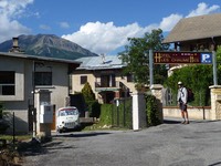
We trudge towards Hotel Les Chaumettes and are warmly greeted by our hosts, a lovely Belgian couple. Our room has spectacular views of the Lake. I'd like to write my blog but we don't have accommodation booked after today. We have a shower, do our washing and hang it in the sunny breezy window, and go downstairs for a beer and Perrier. Christine books Chatereauroux Les Alpes for us and we study the map for the nth time trying to space the days, whilst drinking beer in the beer garden and picking at nuts.
It's all too hard to plan right now and it's already 9pm and we haven't eaten. The hotel doesn't do meals, so after getting our washing that's already dry (the air has no humidity), we walk to the first restaurant we see and order steak, chips and salad - not very Frenchy - but really nice - followed by Creme Brûlée. We are not very hungry and probably should have ordered one between the two of us, so I wrap the left over steak in a serviette, slide it into my map that we had been studying, and walk home. I sit up til midnight (we have a good WiFi connection) checking out options for the next few days and go to bed satisfied that I have found a chamber d'hôte in Prelles, a convenient location to space out the next few days evenly. I turn off the light thinking about whether or not to replace my shoes. I'll think about it. A few hours of restless sleep and I have to get up. The right side of my chest hurts so much I can't turn over. I'm sure I've pulled a chest muscle dragging myself up steep slippery gravel slopes all day. I get up to a have a rice cracker and a Voltaren as I can't have it on an empty stomach, and finally get 2hrs sleep.
